
Seyah’s
Atlas of Atlantis
New Video
Preface
Seyah’s Atlas of Atlantis is the compilation of various theories for the origin of man through the ages. Lost civilizations described in legends, language, history and science.
The Atlantis Islands described by Plato’s descriptions of geography, dimensions and history. In the Atlantic Ocean beyond the Pillars of Heracules.
Geologic interpretation of Plate Tectonics, Fault Slip, Earthquakes, Volcanos, Flooding, Migrating and Sinking of the Atlantis Islands.
Research by Video, Audio and Map presentations of Exploration Targets.
50,000 Years Ago
8 The Deludge
Geography
Teaching Aids:
Atlantis by I.Donnelly, Globe and Geology…
Main Island of Atlantis

La Vela au Zabala


Zabala Island submerged 700 meters since the 17th century.
Sea floor survey shows this mid Caribbean Island is now 720 meters below sea level.
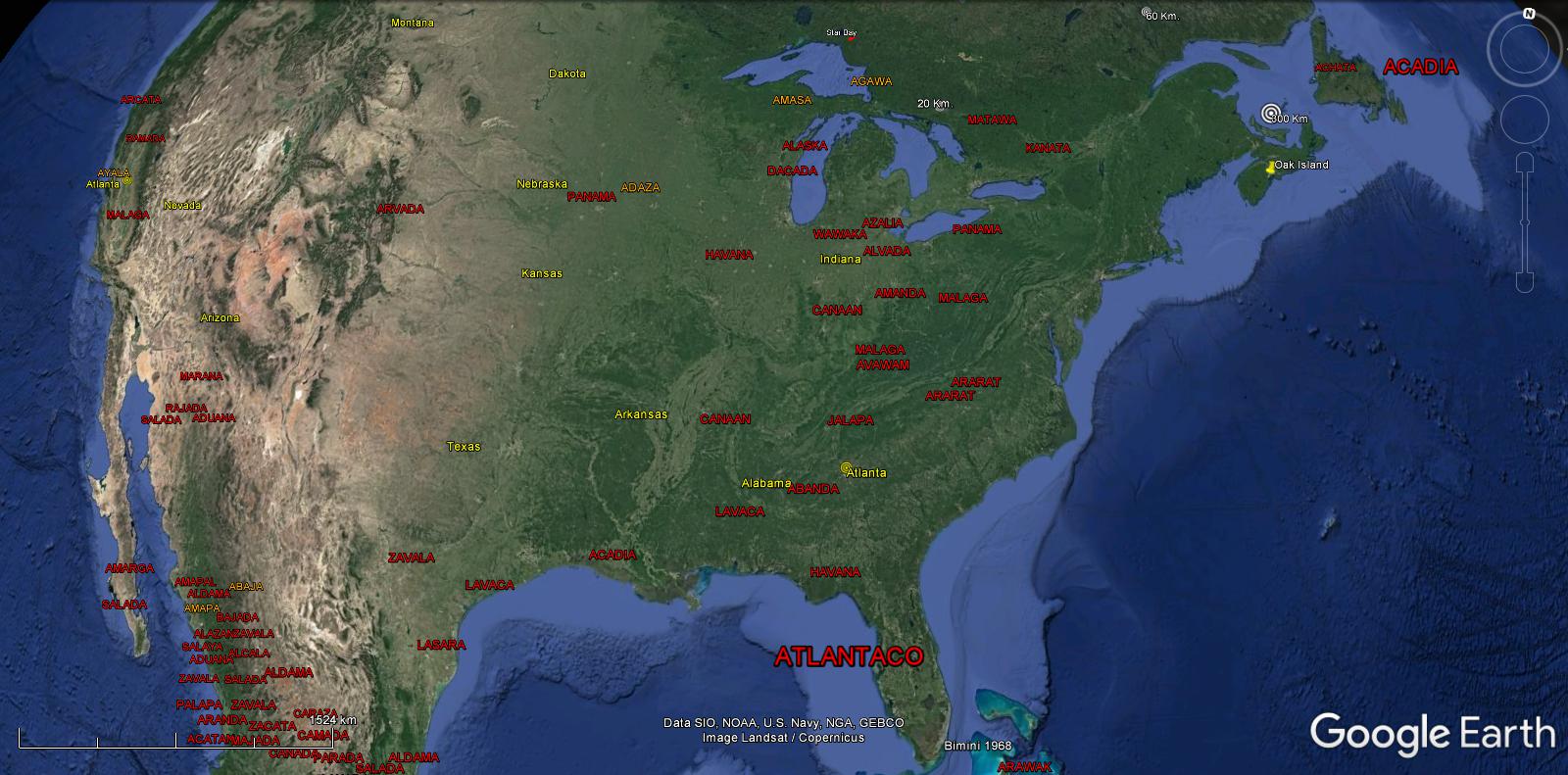
Atlantis became the Caribbean Sea
Caribbean Today

ABAJA ABALA ACALA AJALA AMAGA AMAKA AMARA ANAMA ARADA ARAYA ATALA AYALA
Location
Larger than Lybia and Asia Combined.
Migrating Atlanta Plate


Atlantis


15 Stone to Copper
Geology
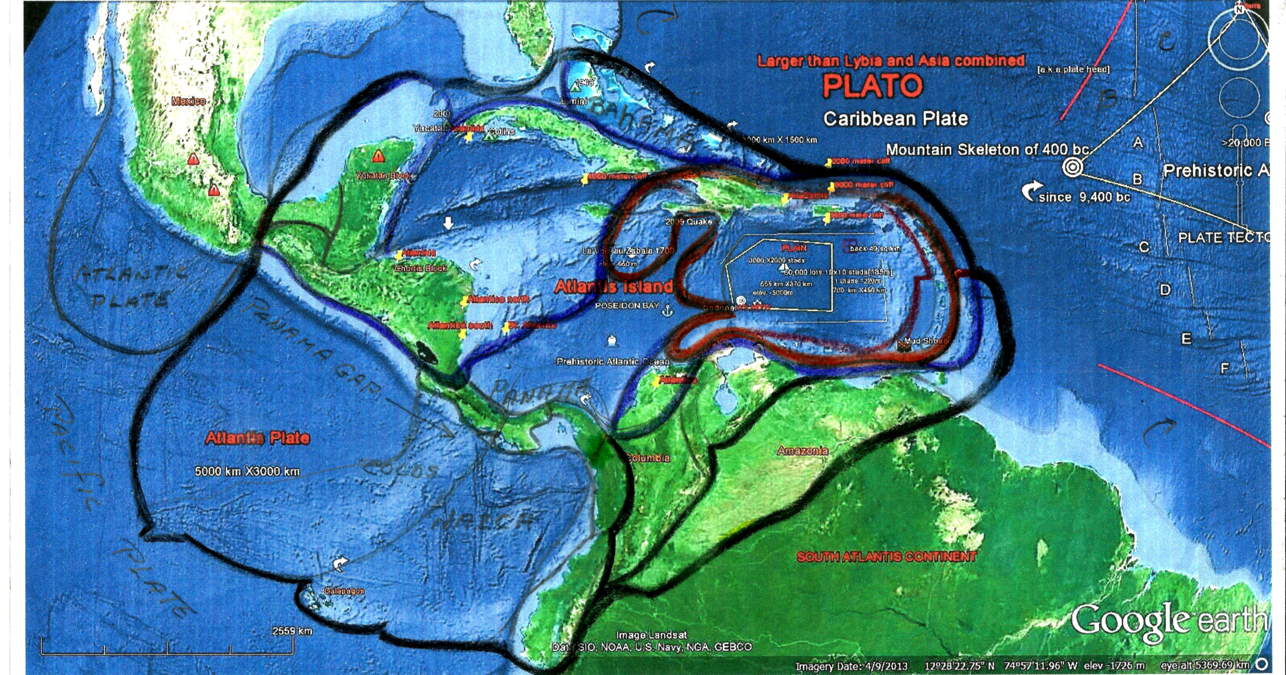
The Atlanta Plate includes:
- The Caribbean Plate
- The Nasca, Cocos and N. Andes Plates
- The Bahamas, Cuba and Yukatan
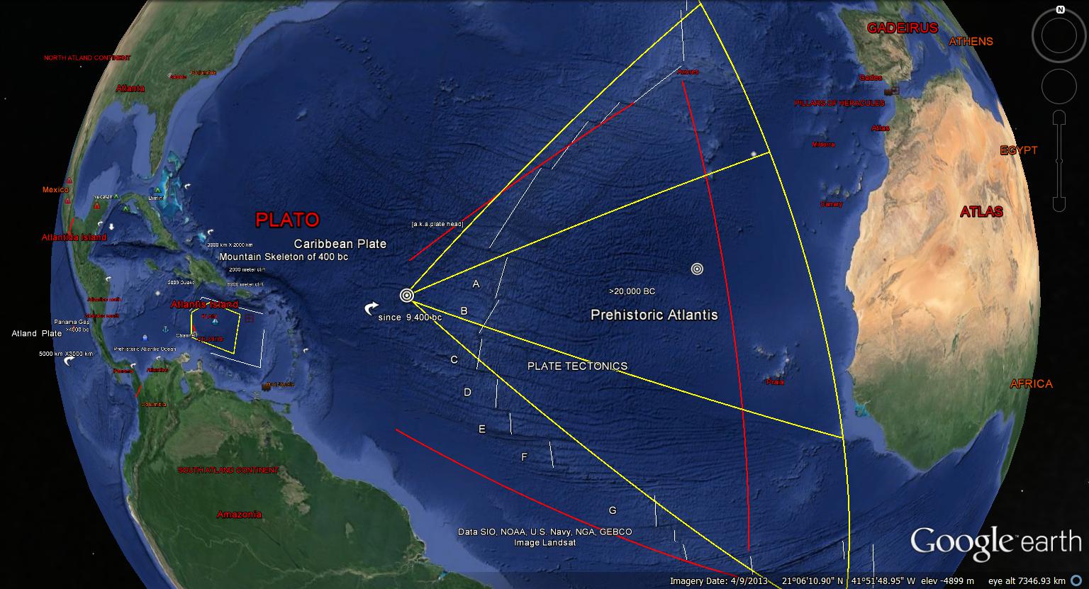
The Atlantic Fault Slips {A-G}, Migrating the plate 2500Km. westward and Sinking 5Km. shown by the Porto Rican Trench on the east and 2Km. on the west shown by the Submerged Yukatan Showing of 2001 and the “Atlanta Target” shown below.
Teaching Aids:
Plate Tectonics, Earthquakes and Volcanoes…
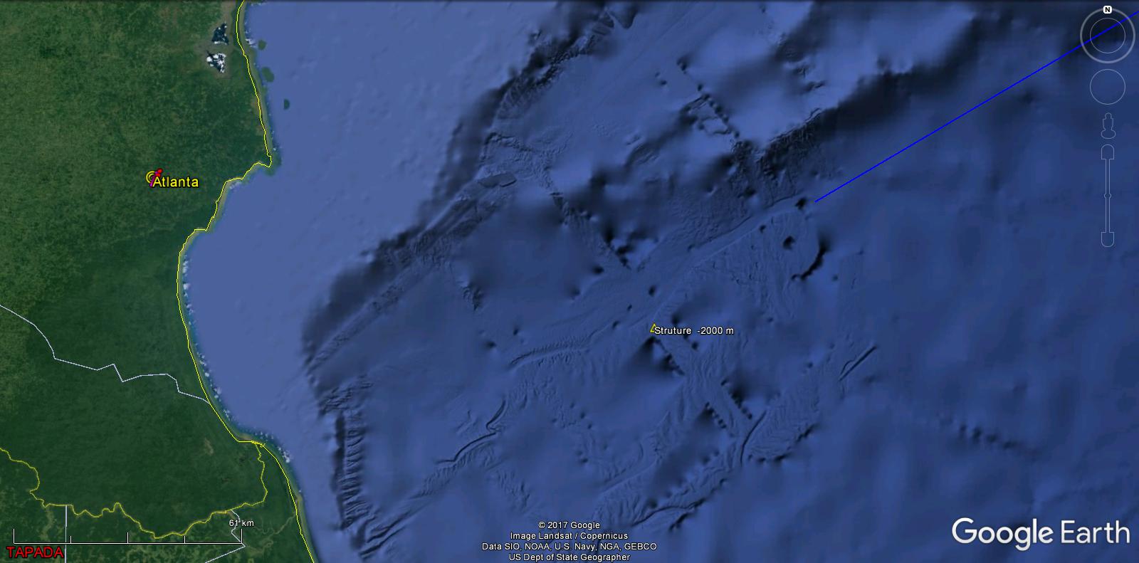
Nicaragua
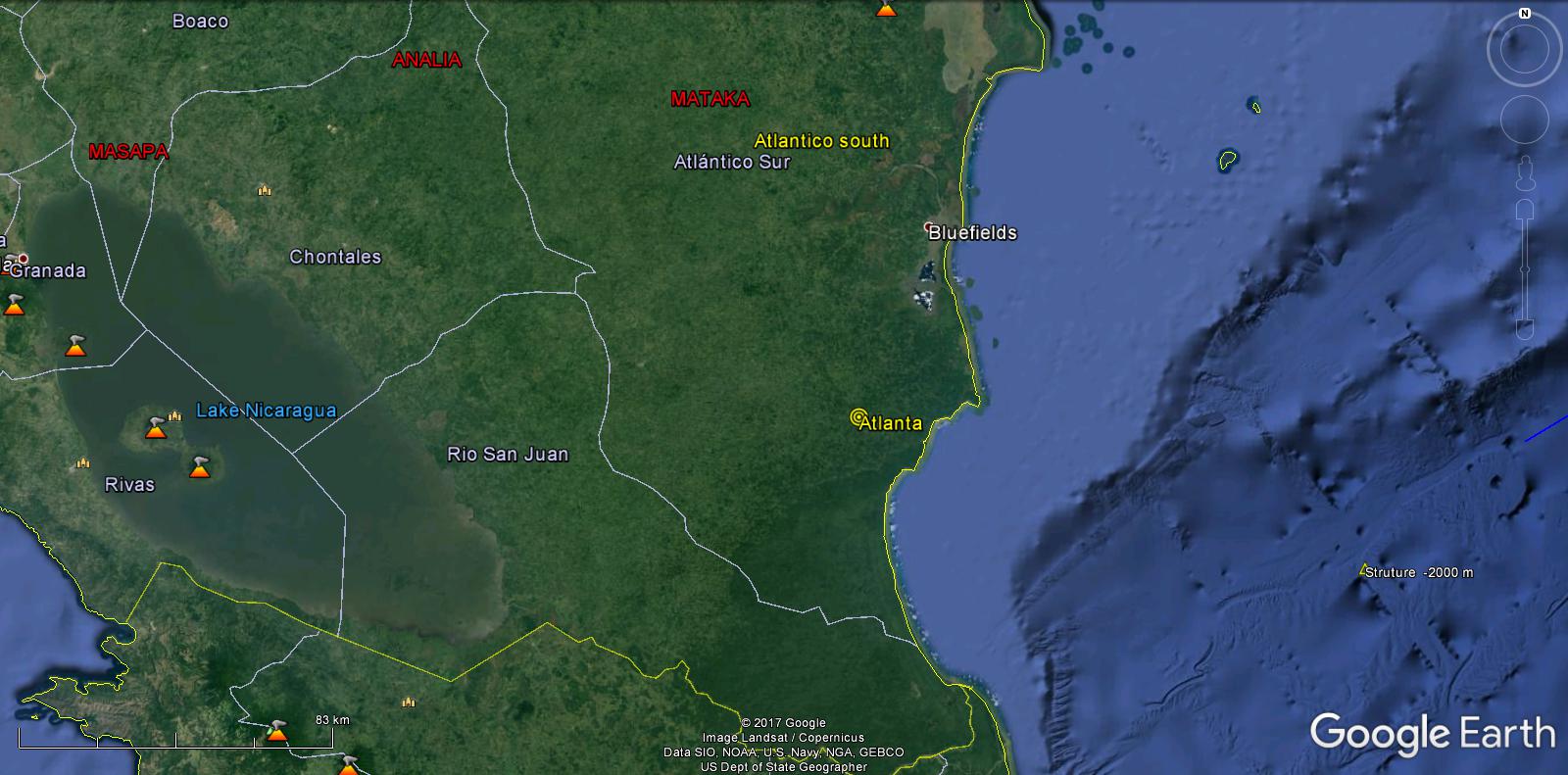
Atlanta
The Atlantic Continents
19 Atlantic
Primeval Languages

22 Alphabet
Our data base{below}illustrates the origin of name places, is a sequential progression from a common source. There was no E, I, O, CD were synonymous as were PQ, UVW and XY.
Cromagnon Conflagration
Beginning with the A’s, AAB-AAZ was the Megalithic Era. Destroyed by Fire. Plato/Timaeus “… Phaeton, Son of Helios…Conflagration…”
“..though known in myth, this describes a declination of bodies that orbit the earth…” Plato
End of the Neanderthale
Language Migrations
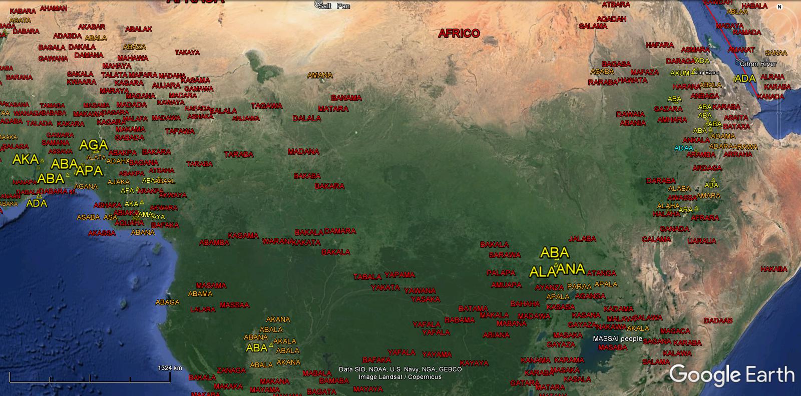
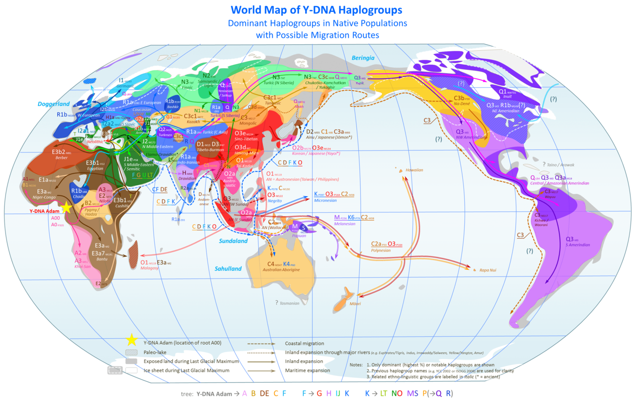
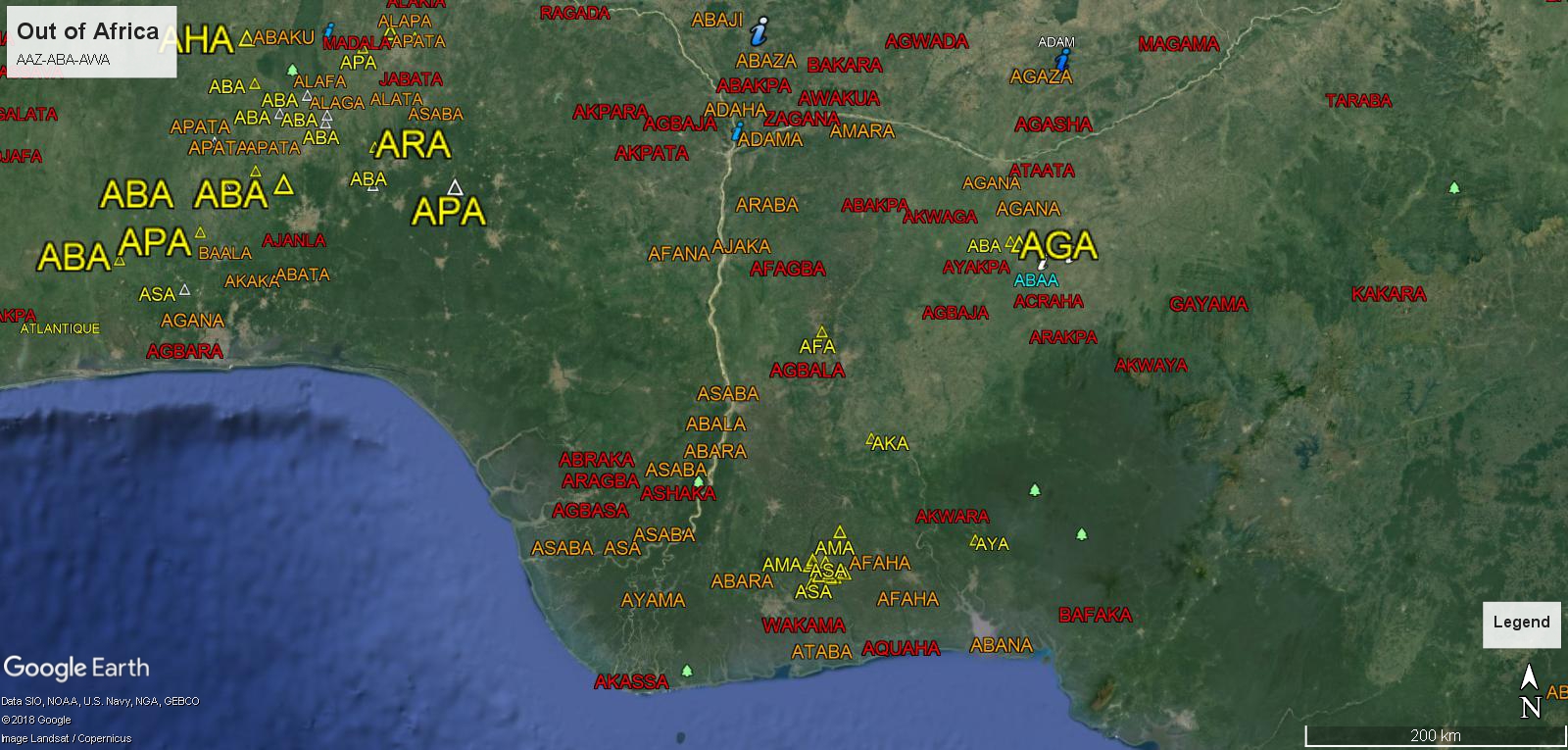
Modern Man came out of Africa, ABA-AWA, ABAAL ABABA Nigeria and Etheopia, the same as the DNA, X-Y Chromosome Genetics. Migrating around the world ABAFA ABAGA ABAHA ABAJA ABAKA ABALA ABAMA ABANA ABAPA ABARA ABASA ABATA ABAWA ABAYA ABAZA.
Teaching Aids:
Genetics, Language and Mythology…
Genetics
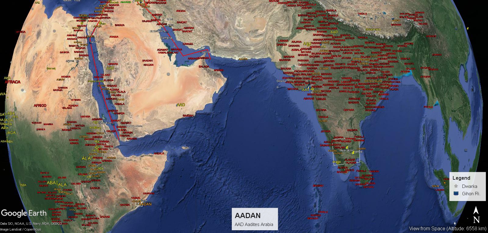
AADAN,ADAAM, ADAMA, ADANA, ADAPA
Aadites, the Megalithic Era.
26 Aadites
AAB-AAZ
Etheopia
Lebanon
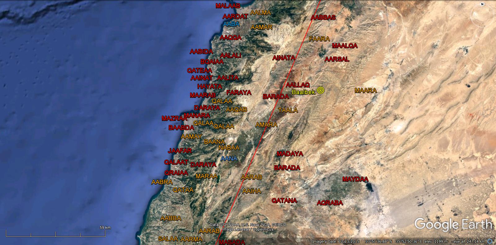
29 Phoenicians
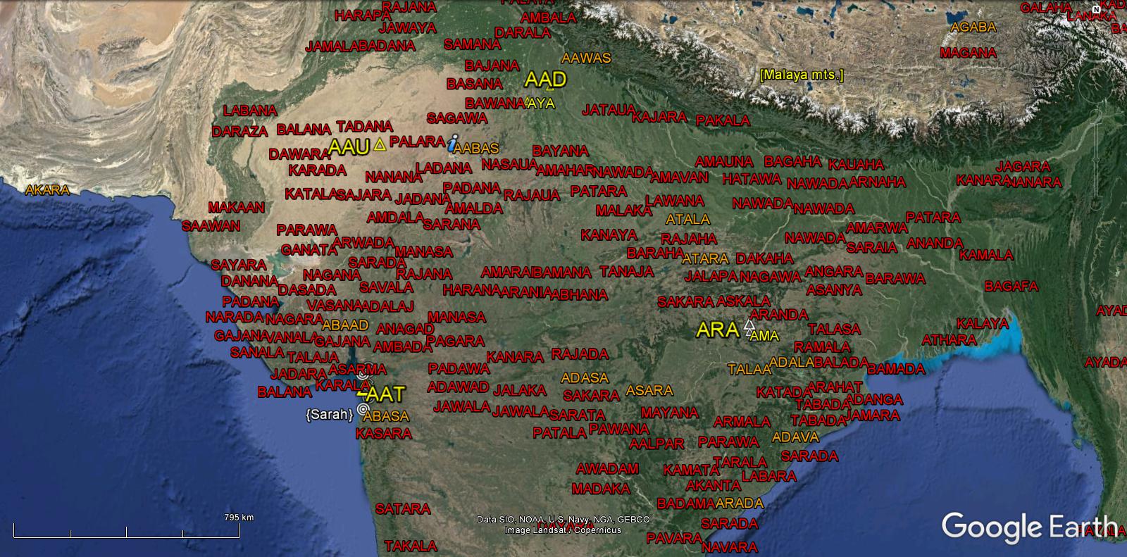
India/Dwarka
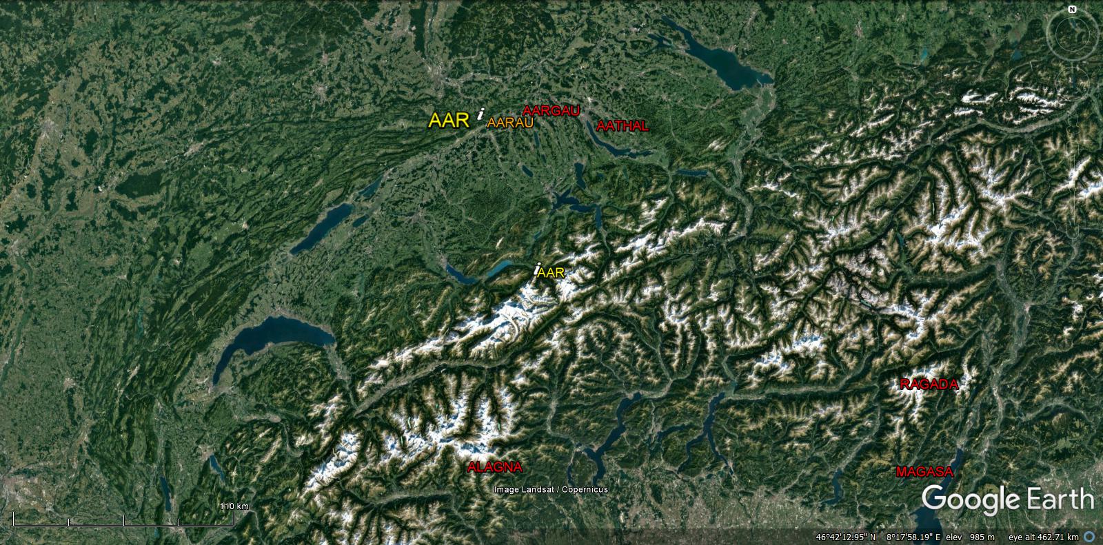
Switzerland
Estonia
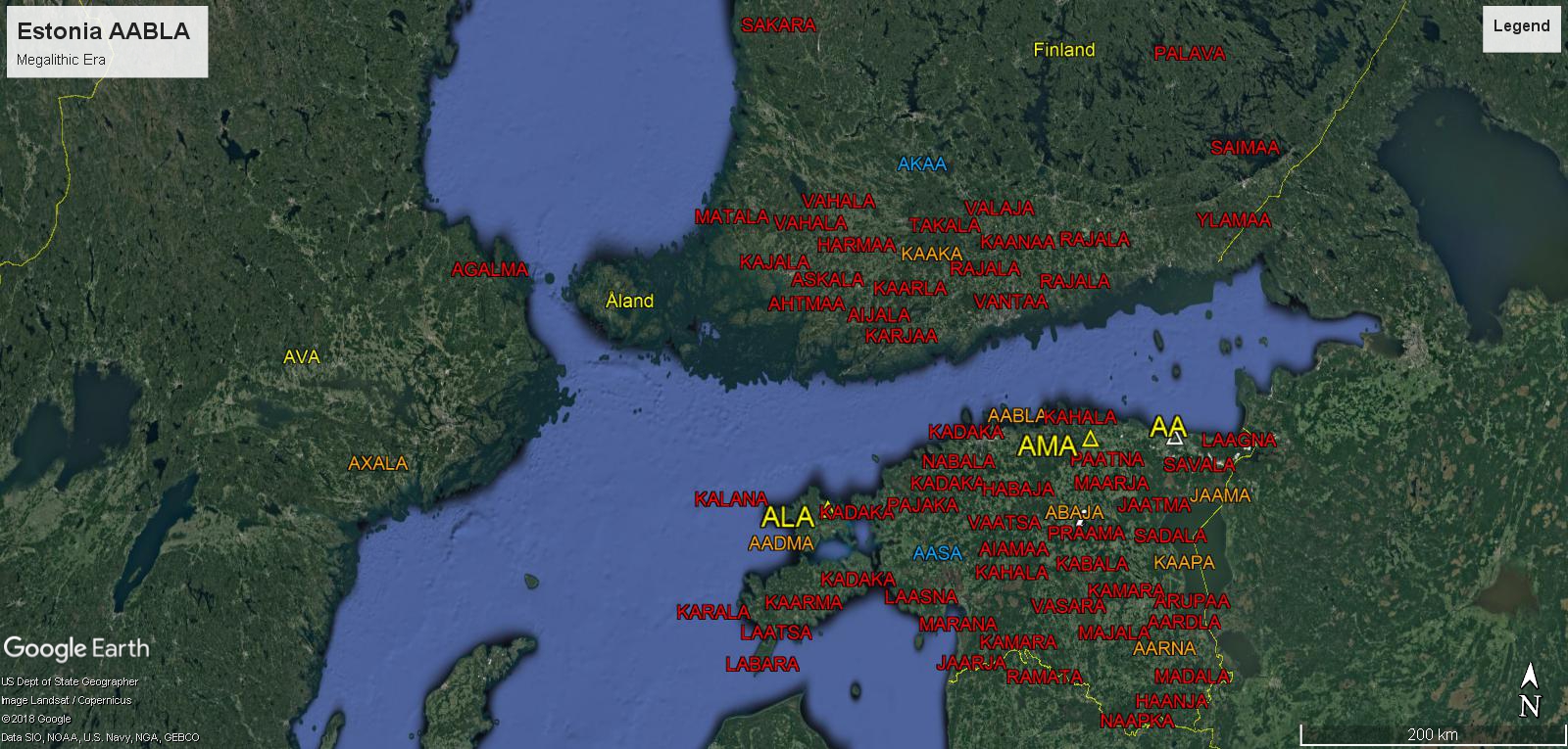
40 Ireland/Estonia
Atlas Mountains
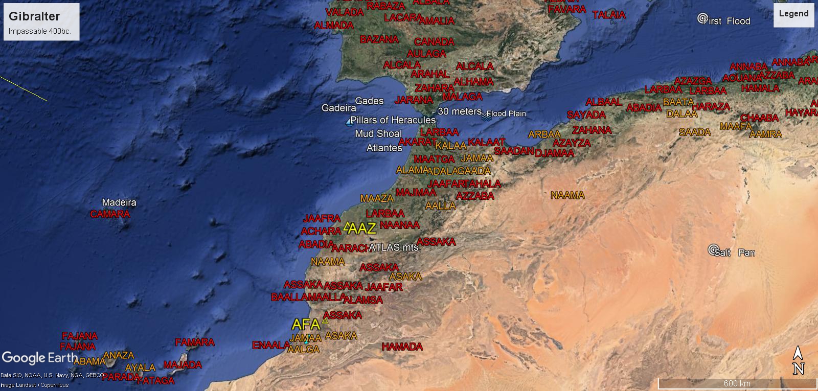
39 Africa
Spain/Iberia
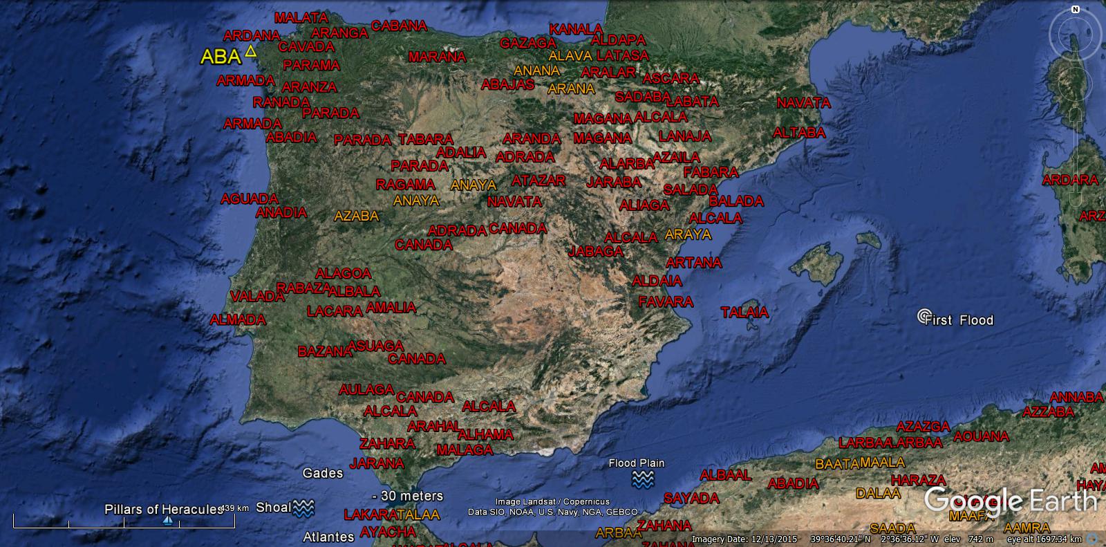
ABA appears as the first Colony given to Gadeira {Gades}, the second born King of Atlantis. The Kingdom towards the Pillars of Heracules, where the Basque survive today.{Soloureans}
37 Spain/Iberia
ABA
Mexico
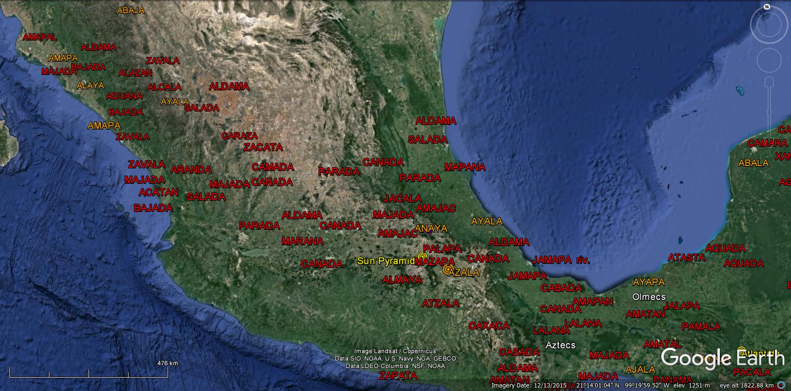
Like the sunken Atlantis Islands {ABAJA}, Mexico has Megalithic evidence of it’s first era.
34 Mexico
Peru
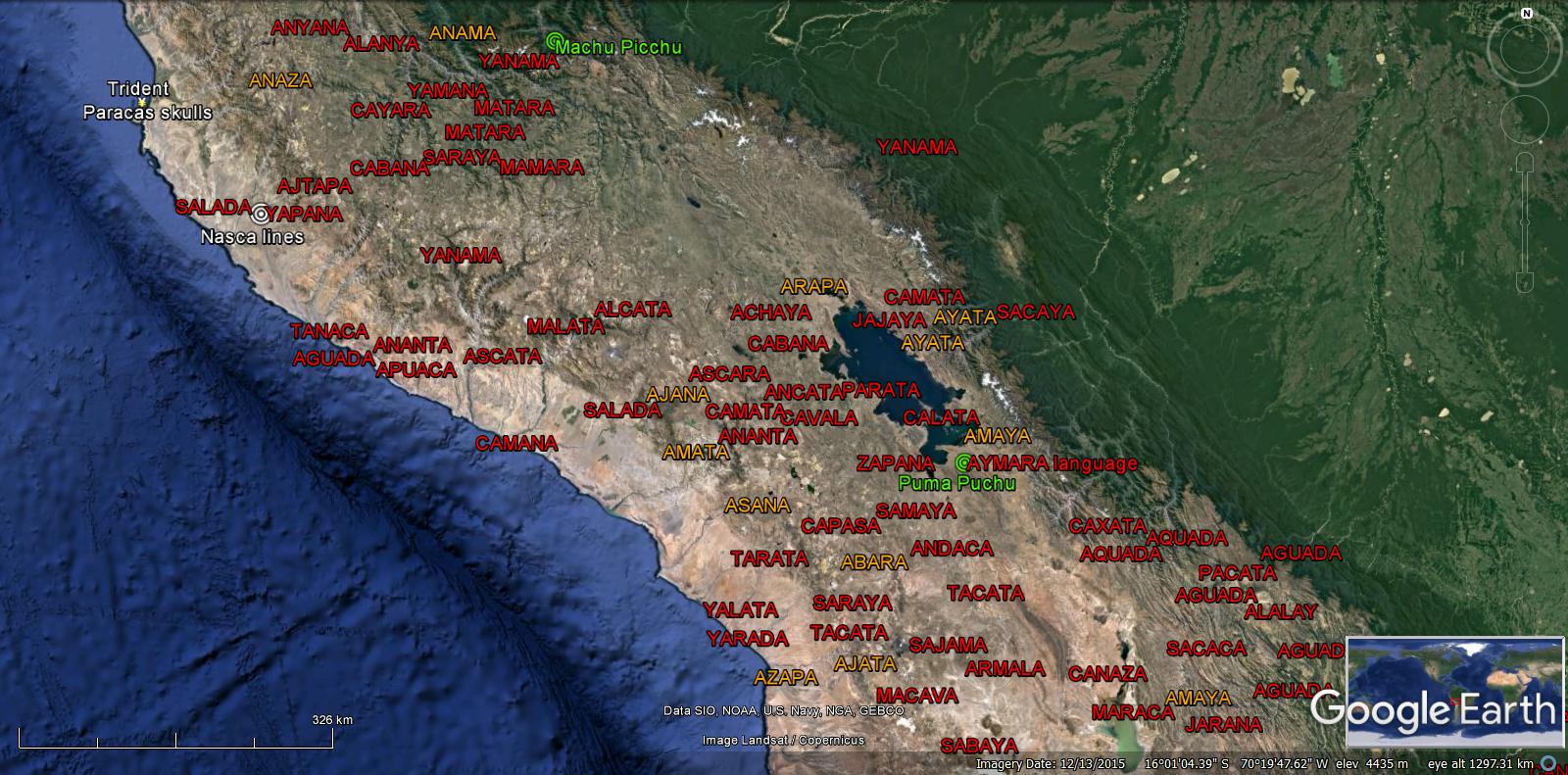
The remarkable Megalithic Structures is evidence of the Era, only showing the migration to Argentina and on to Peru, ABAPA to ABARA.
38 Peru
———————————————————–
Earth Born Primeval Man
ABA-AWA
The Great DNA Diversity of Sub-Saharan Africans is proof that it was Spared the Greatest Deluge of All, as well as the African Elephant, Giraff, Rhino, Hypo, Lion and Humans.
ABA – AZA
Ethiopia
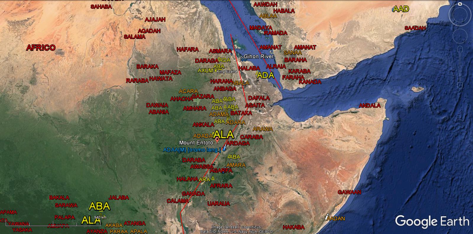
Nigeria
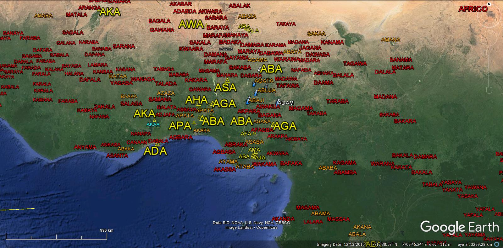
Gabon/Congo/Tanzania/Kenya
Modern Man
Out of Africa
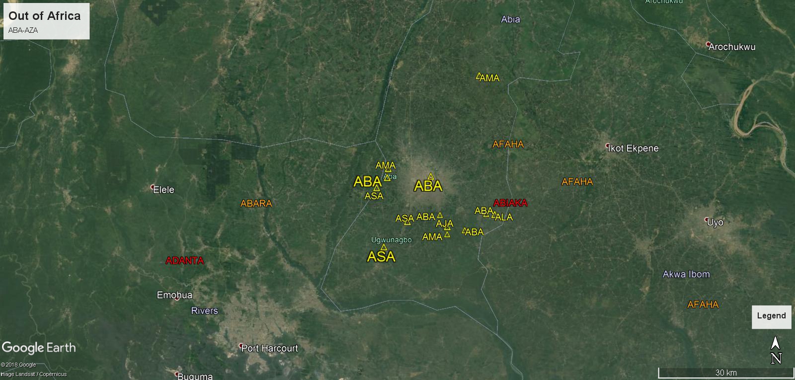
Migrations
ABABA-ABAZA

Link
Blood Type Frequencies by Country including the Rh Factor – Rhesus Negative
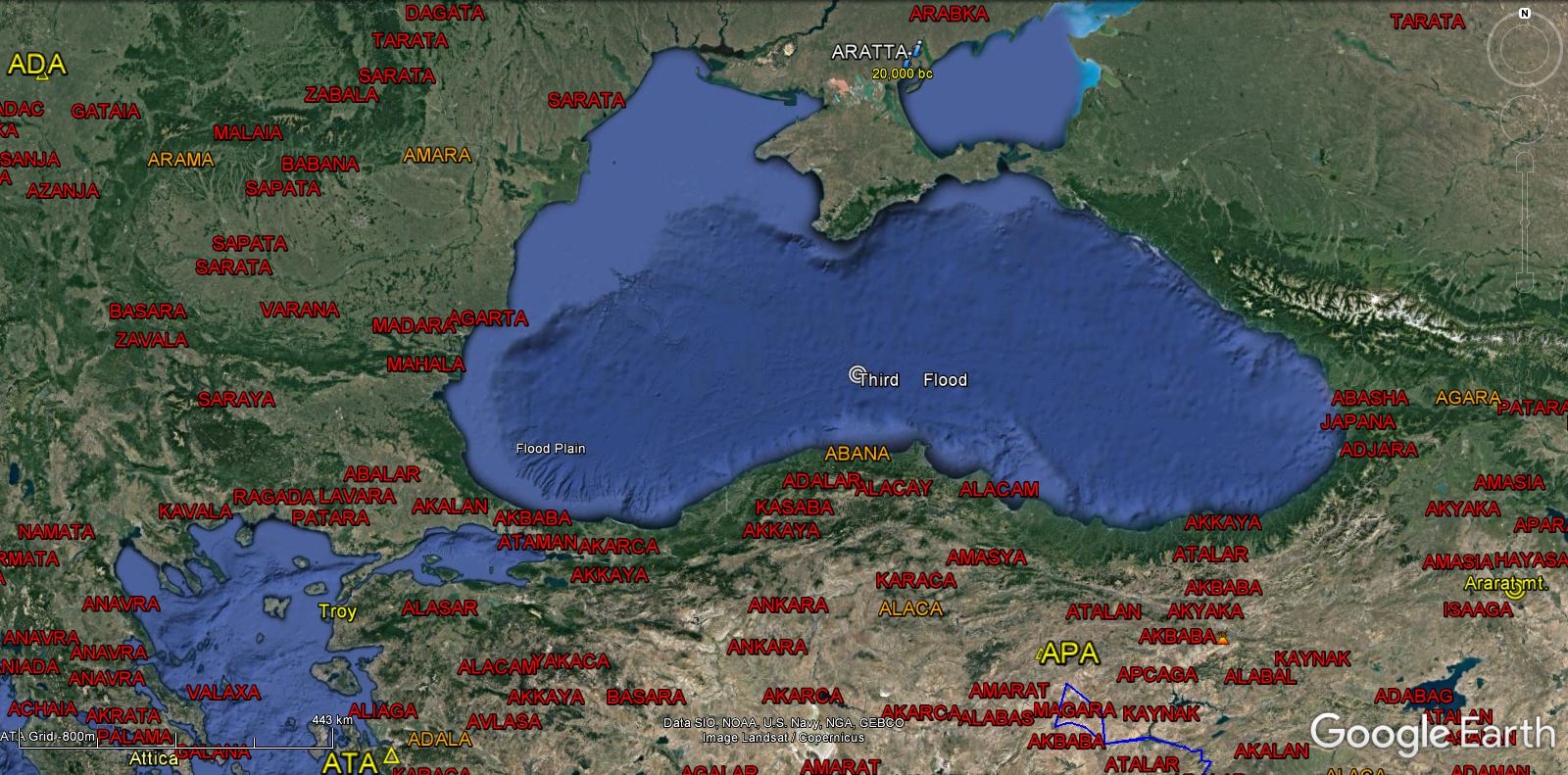
ARRATA/ARATTA
PLATO
Beyond the Pillars of Heracles
Atlantis was founded before Ships and Sailing and sunk completely, 9,600Bc.
This Atlantic discovery confirms Plato’s account of the Atlantis Islands adjacent to Africa, Europe and the American continents. Bounded or part of the Azores, Madeira, Canary Islands in the northeast and North/South America to the west.
Horses and Cattle were bred and perfected by Atlanteans before 14,000 Bc, as well as all the Hybrid Animals and Crops up to modern times.
Writing, Weaving, Sailing, Chariots, Metalluregy, Masonry, Kingship, Military, Mapping, Astrology, Geometry…
All according to Plato’s descriptions.
——————————
And God Created Man in His Image…
ADAMA appears in Nigeria and Ethiopia.
Atlantis, Aliens or Gods?
44 Atlantis
ABAJA ABAKA ABALA ABAMA ABANA
43 Arians
Atlantean Colonies
ABANA
The South Shore of the Black Sea, since Flooded 6,000Bc.
Agriculture in Asia Minor and Fertile Cresent
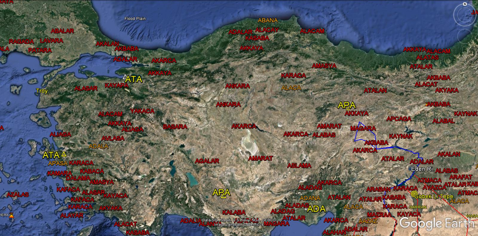
Anatolia
Athens
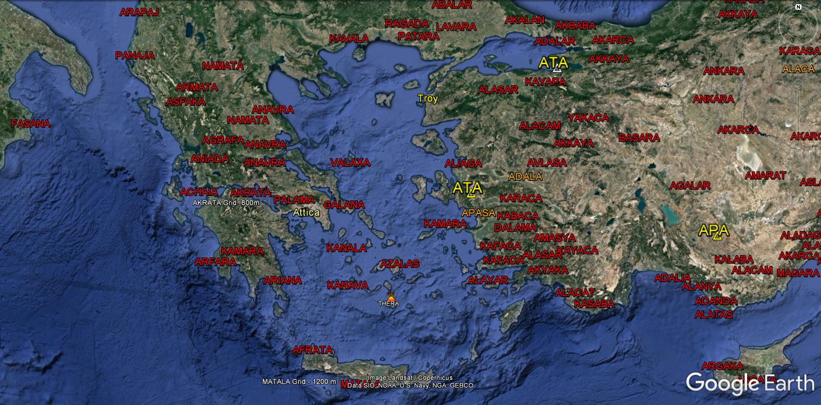
Athens/Attica was part of Anatolia before it’s destruction, “founded 1000 years before Egypt was founded.” Plato Timeaus 400bc.
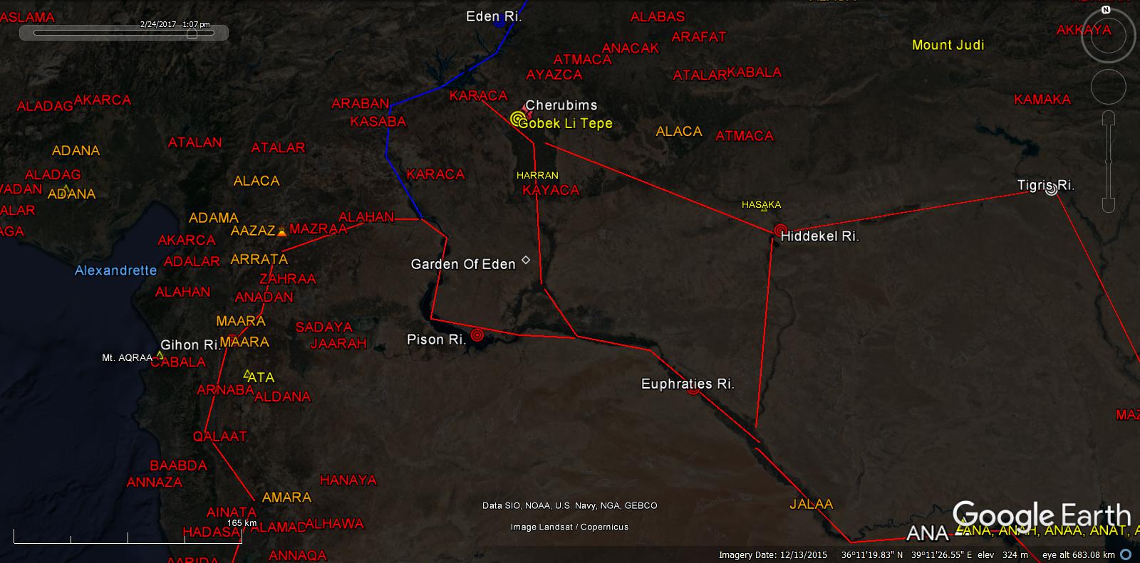
And a river went out East of Eden, to Water the Garden…
“…And God Placed Man in the Garden, to Dress and to keep it…”
ADAMA, appears in the Garden of Eden
Genesis-by- King James link
New Beginnings
Teaching Aids:
Bible, Atlantis, Sumerian text…
ADA ADALA ADAMA ADANA
Thence split into 4 Rivers…
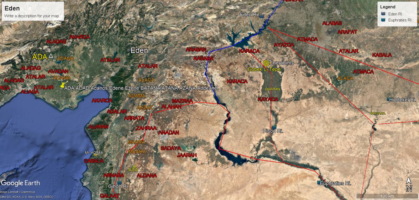
The Pison, Gihon, Hiddekel and Euphraties
Cities on the Gihon River
Now the Jorden River, once extended from the Eden River through the Red Sea and all of Etheopia to the Gulf of Aden.
Places on the Gihon River; Mecca, Medina, Petra, Jericho, Baalbek, Dead Sea, Sea of Galilee, Jerusalem, Hebron, Sodom, Gomorrah and Mt. Hermon…
ADA, AGA, AMA, ANA, APA, ATA, ADALA, ADAMA, ADANA, ADAPA
Expelled from the Garden of Eden
“In the sweat of your face shall you eat Bread”… Agriculture!!
“..Lord God drove out the Man; and he placed East of The Garden of Eden Cherubims and a Flaming Sword which turned every way, to keep the way of the Tree of Life.”
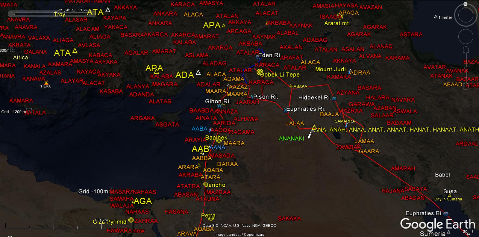
Harran
Abram’s Ancestral Home Lands
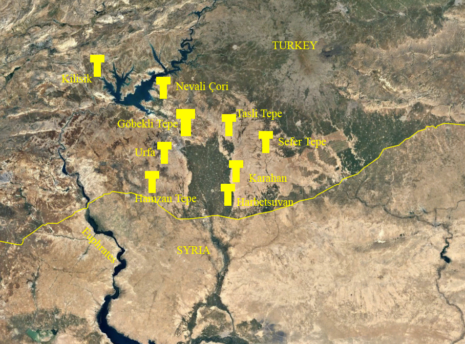
Gobec Li Tepe
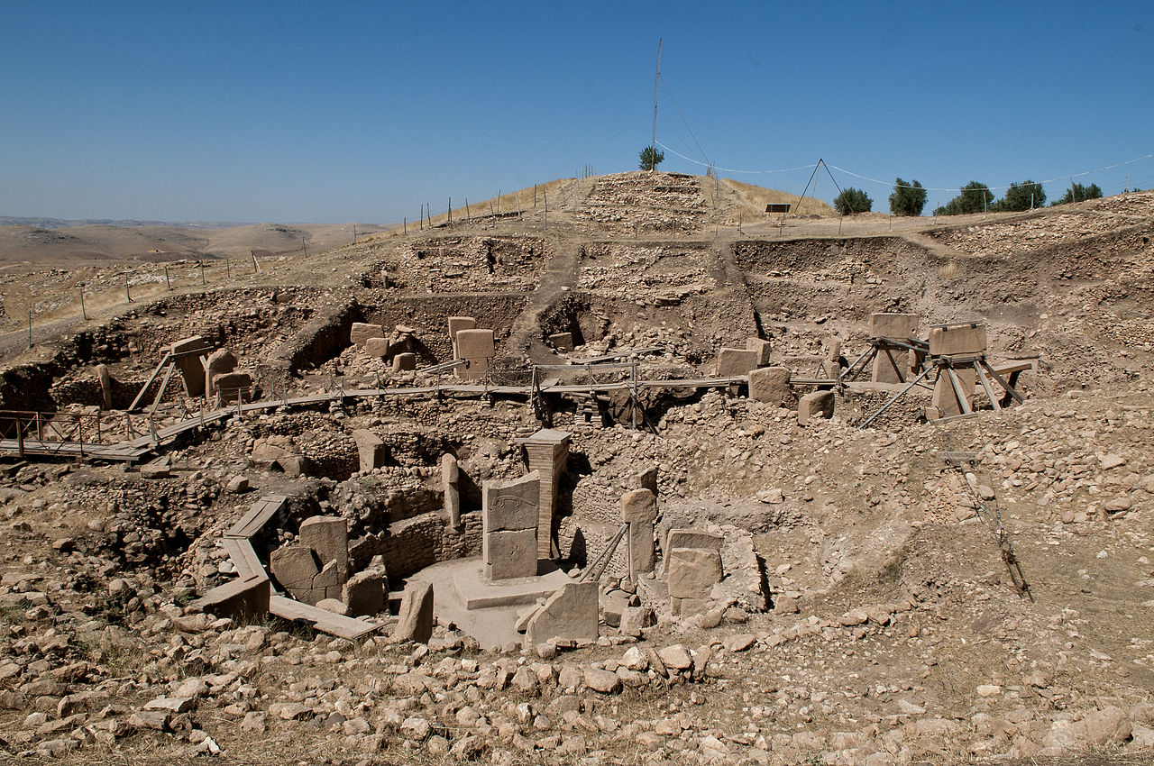
Gobec Li Tepe was Destroyed and Buried by the Massive Floods of 9,600bc.
In one day and night Atlantis Sunk beneath the sea and all your warriors likewise where lost…Plato
The Tsunami caused by Atlantis sinking would have destroyed North Africa, Europe and the Middle East… and more!
This happened after the long War of the Titans, Atlantis was defeated by the Athenians…Plato
Bottle Neck
Egypt
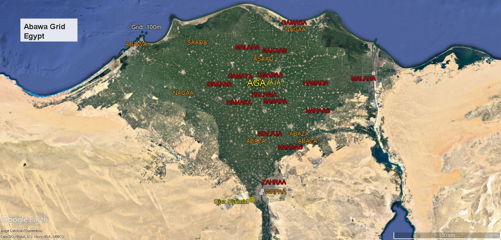
35 Egypt
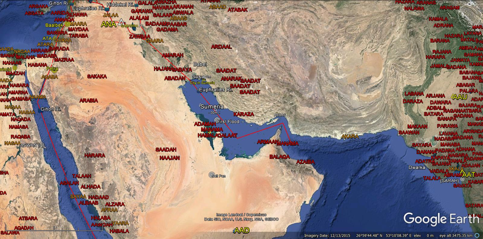
Sumeria
Half Million Years Ago
Genesis 6:3
“And the Lord said, My Spirit shall not always strive with Man, for that He also is Flesh: yet His days shall be an hundred and twenty years.”
———————————————-
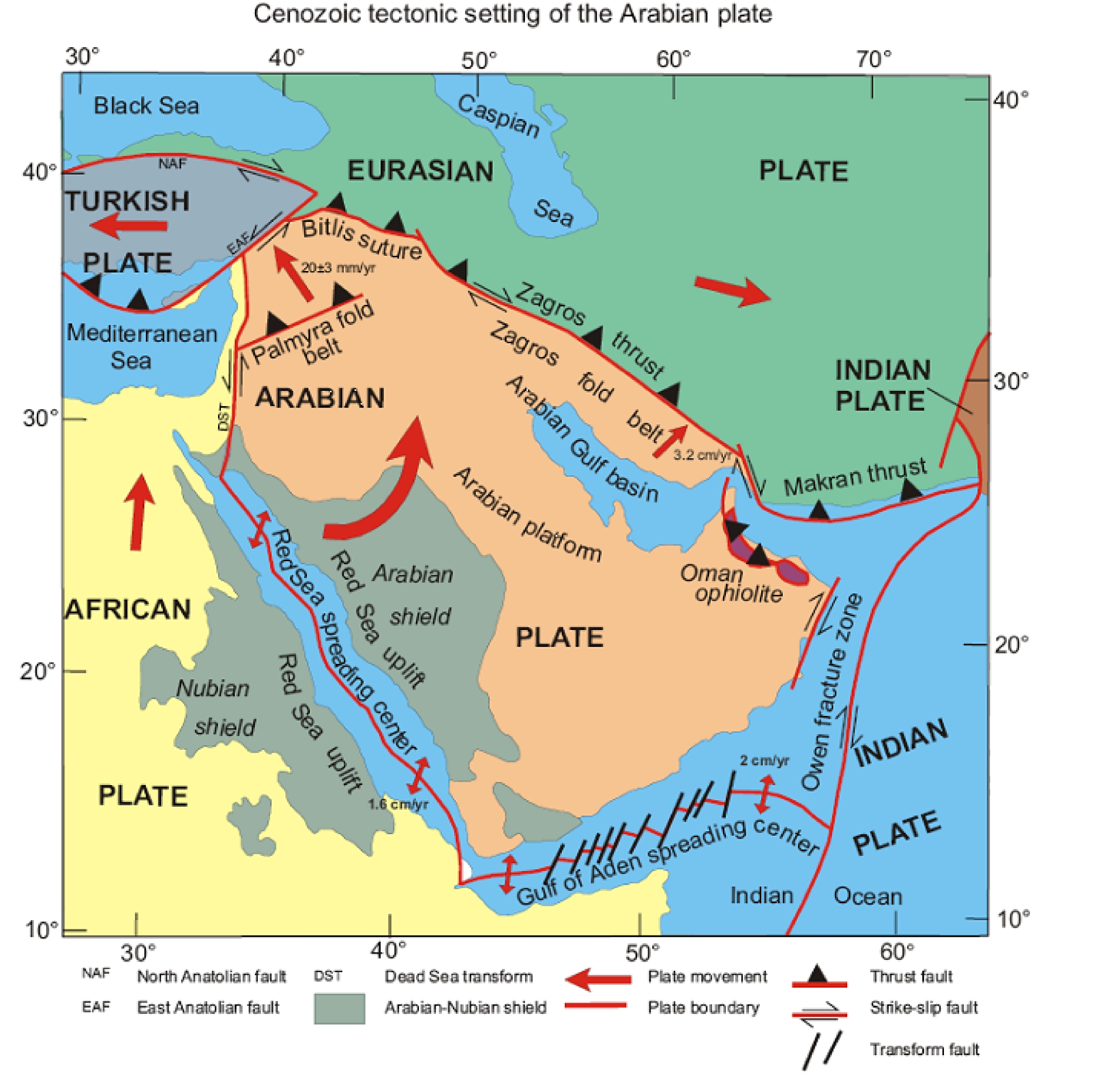
Plate Tectonics
The Fountains of the Great Deep Broke Out

Teaching Aids:
Geology, Plate Tectonics and Younger Dryas…
Atlantis Submerged 9,600bc.
“..and the water prevailed exceedingly…”
The Waters from the Deep, receded into the newly formed Atlantic Basin.
Creation of the Atlantic Basin

Caribbean


Mid Atlantic Fault Slip Events.
North America rotated clockwise as South America rotated counter clockwise.
The Atlanta Plate migrated westward as shown by fault slip of the Mid-Atlantic.{A-G}
The main Atlantis Island, Atlantica illustrated above.
———————————————————–
Flood Legends
“…you remember only One, there were Many, before and after…”
Atlantis was spared the onset of the YD Pulse A Floods. Protected by Mountains to the North and building Sequential Flood Dykes. The Solourean in Western Euorpe and Eastern America was Destroyed {12,900 bc}. America was repopulated by the Clovis people from Atlantis with the Fluted Points till 9,600 bc. The technology was mass production that supplied the Atlantian Military Atlatl Slings and Spears.
The Fountains of the Deep broke out YD Pulse B Floods, Atlantis Sunk and Tsunami’s again destroyed Western Euorpe, Northern Africa, Eastern America and the Countries within the Pillars of Heracules.
Gods from Atlantis
12,900bc to 2,400bc.
Pillars of Heracules
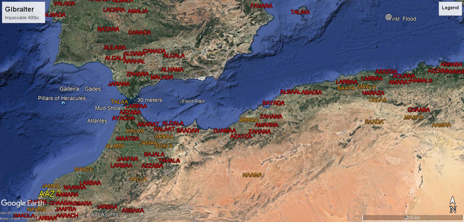
Strait of Gibralter was Impassable { Plato 400bc.} due to the quantity of Mud… now at 30 meter depth, Sea Level has risen 100 meters since 12,000 bc.
Noah’s Flood 6,000 bc.
Atlas{mountains}Holding Back the Heavens Above as Sea Level Rising…

Sumerian Flood 3,000 bc.
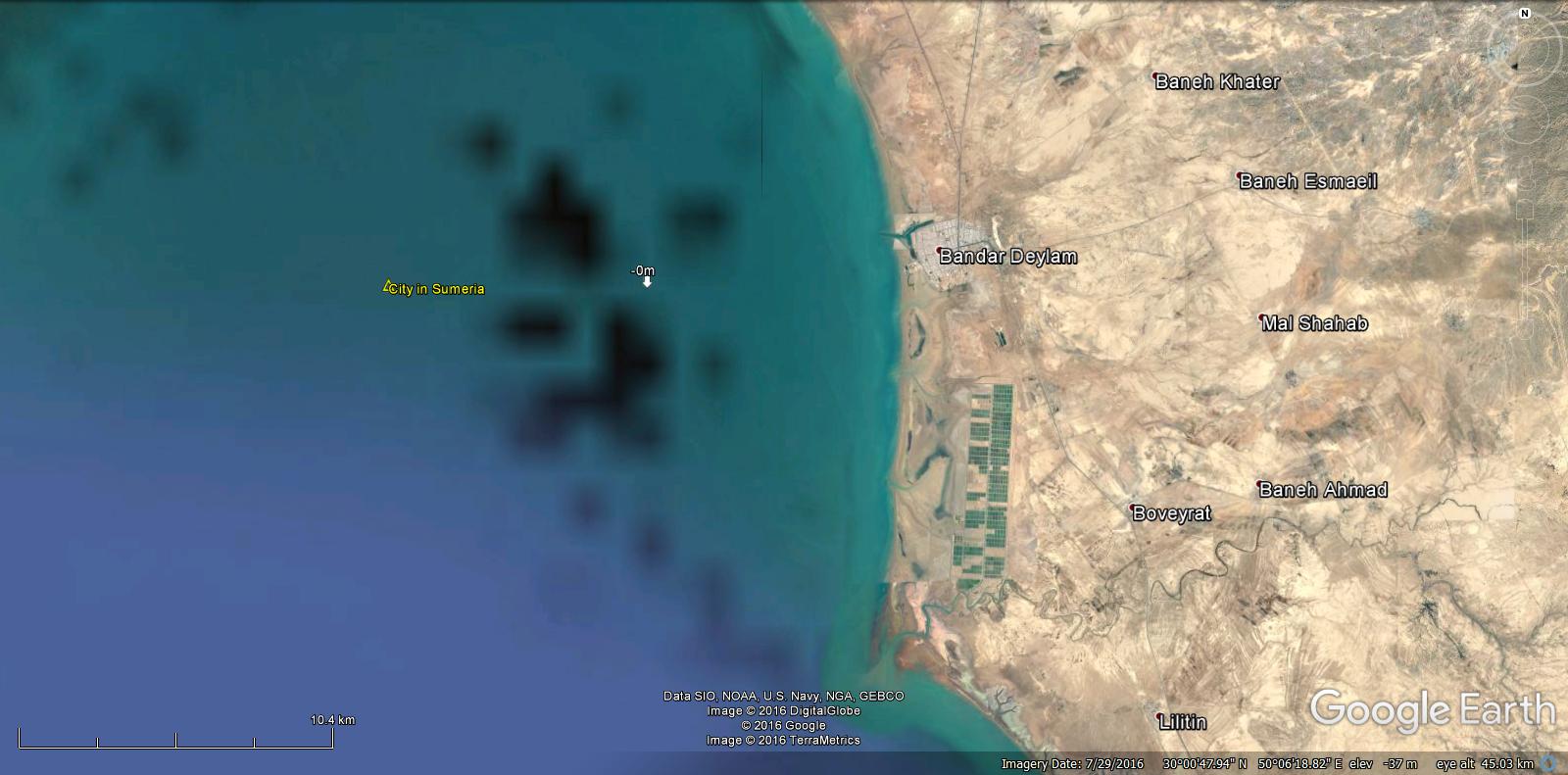
Submerged City in the Persian Gulf near Susa
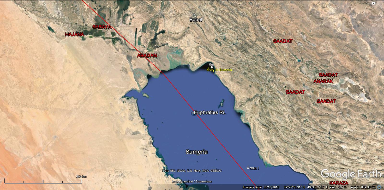
Susa Target
Sumatra ABAJA was a very large Land Mass connected to Australia.
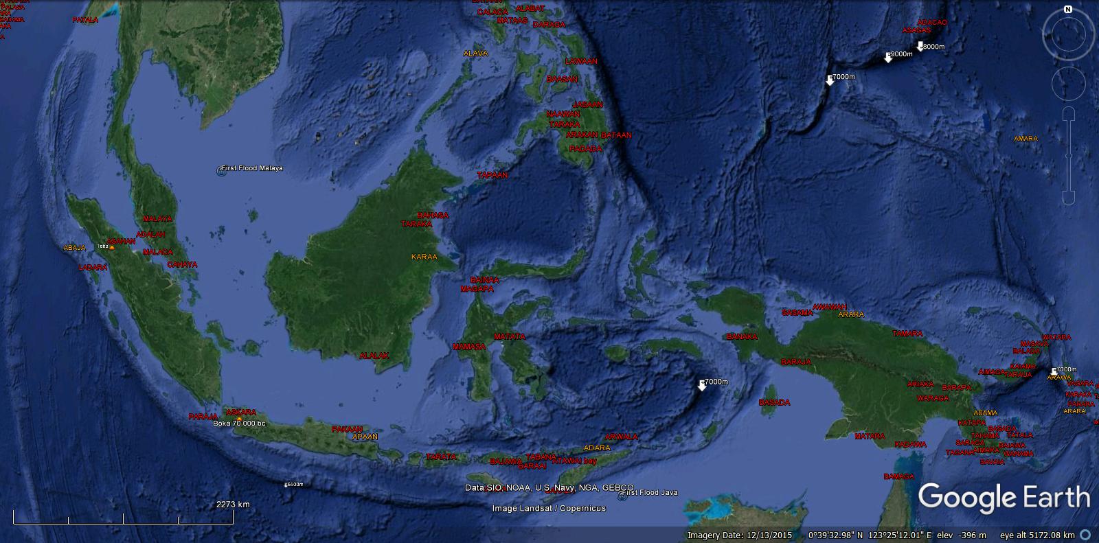
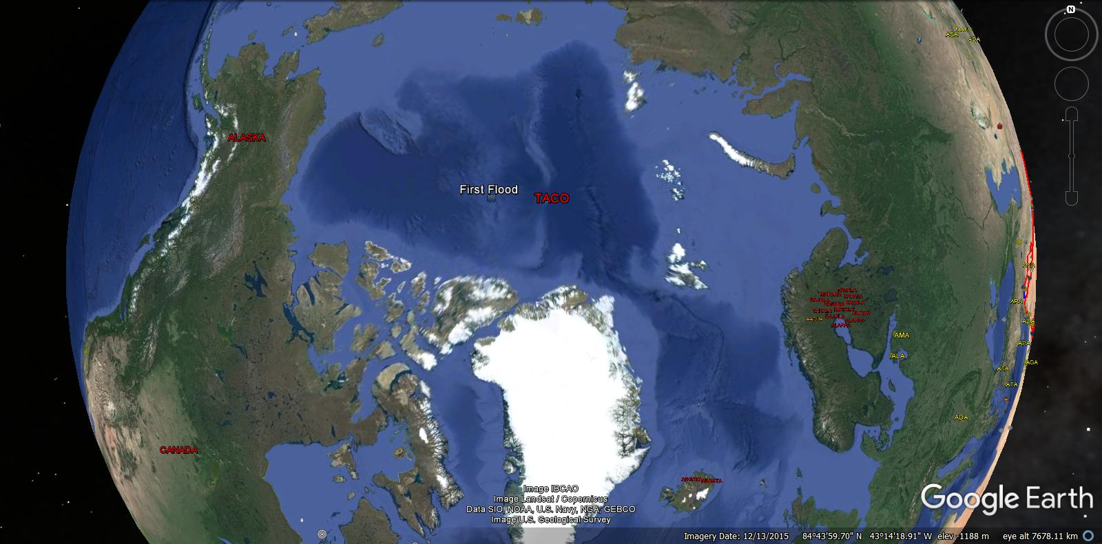
Most of the Arctic Ocean, Bering Straight and all the Baltic Areas, Sea level Rising 400 feet Since 10,000 Bc
24 Bronze Age
Pre Flood Maps
 Pietro Coppo Prehistoric Atlantis
 Pietro Coppo Prehistoric Atlantis
 Waldseemull Historic Atlantis
 Waldseemull Historic Atlantis

Where is the Caribbean Plate ?
Prehistoric Mapping

Piri Reis Map

Teaching Aids:
Ice Ages, Younger Dryas and Floods…
North American Floods

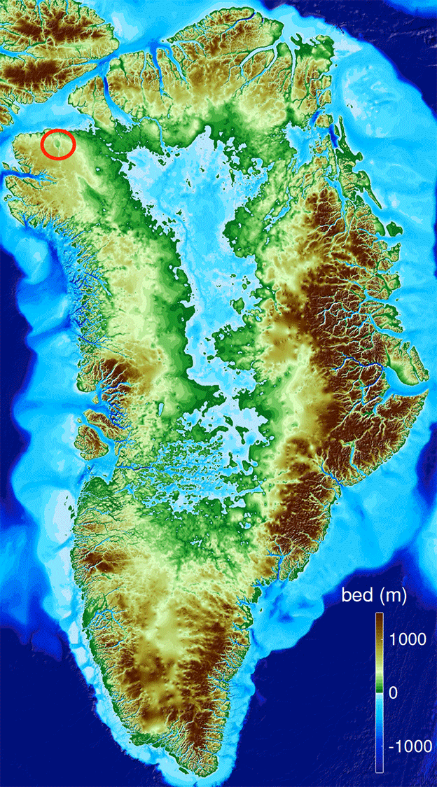
Lake Agassiz formed under the Ice, for the same reason a lake never freezes to the bottom.
The heat of the Earth, insulated by the Ice sheet, melts the ice in the same way our water pipes do not freeze under ground and fish are comfortable in winter. For example, Greenland.
Flooding through the Mississippi to the Gulf of Mexico.
Carolina Bays
Carolina Bays
The North American floods, with icebergs of the Younger Dryas impact floating in the water, created the Carolina Bays.
As the ice blocks covered North America, that flattened mega fauna animals, left bays as they melted away. The flood water ended and the bays with rims were preserved.
The orientation is that of the flood directions and the reason the black mat is not associated with the Bays, as repeated floods occurred before the icebergs were deposited in their final position.
We conclude that Lake Agassiz over flowed many times as the landscape rebounded, from 11,000 to 8,000BC., after the main Younger Dryas impacts. The final flood occurred after the fountains of the deep erupted, ejecting hot water and mud as Atlantis sunk beneath the sea, 9,600BC.
The last of the Clovis People
The Solourians of Spain and the east coast of America may originate from the Islands of Atlantis that predate the Clovis and the Younger Dryas.
Younger Dryas 10,900 bc.

Temperature

Comet Impact
The 1300 year sediment unconformity may be a Frozen North America with no summer under meters of ice and snow.
9,600 bc.
In one Day and Night
The destruction of Atlantis and The Fountains of the Deep breaking out was the Extreme Warming, Floods, Tsunami, Earthquakes, Volcanos and Wide Spread Sedimentation.
————————————————————————–
 Atlas of Atlantis
Kircher Map


Plato’s History of Atlantis{Donnelly}
2 Timaeus
3 Criteus
Raising Atlantis
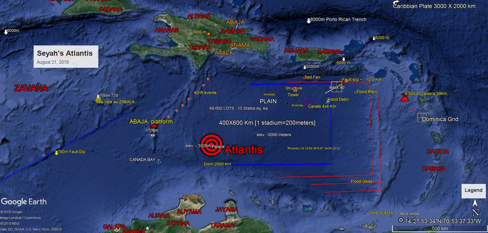
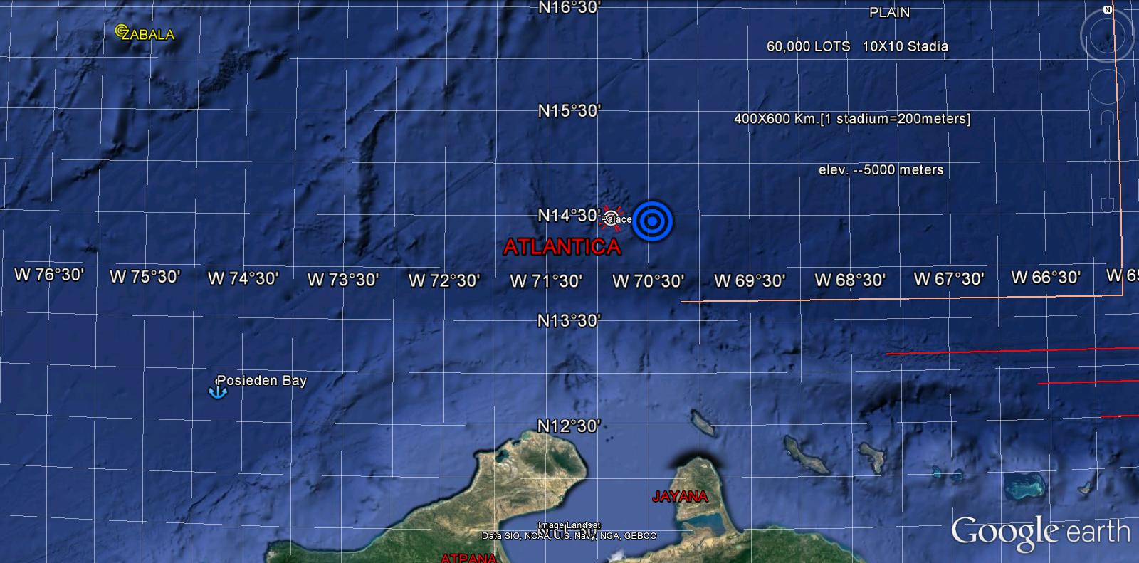
Atlantis became the Caribbean Sea 9,600 BC ,after migrating and sinking 2500 km westward, and 5 km below sea level today.
According to Plato, Atlantis was beyond the Pillars of Hercules in the Atlantic Ocean. Composed of many islands, larger than Libya and Asia Minor combined.
The main island was a plain 400 x 600 km, enclosed by a canal 2,000 km in length, rectangular and oblong in shape, in the center of the island. There was a mountain, also near the center that contained the city, 10 km from the sea to the south. Canals crisscross the plain 2 km apart.
The whole island is shielded by great mountains in the north and open to the sea in the south.
The discovery is an island 2,000 km in length and 1,000 km across the center of the island.
The mountain within the plain contains the Palace, Citadel, the three circular Canals and a wall surrounding the whole city, 27 km in diameter, near the sea. Also features a flood plain, debris , dykes, tower, pyramid and volcanos dated at 9500BC.
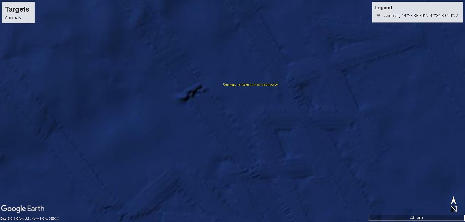
Exploration Targets
Teaching Aids:
Remote Imaging, Submersables and Software…
The Citadel
 Citadel within the plain
 Citadel within the plain
2000 km. Ditch, Canals and 60,000 Lots
“On a Mountain, not very high on any side…”PLATO”..Also towards the Center of the Island…”
Poseiden’s Palace


 Dimentions 1 Stadia= 200 Meters
Circular Ditches of the Metropolis and Stone walls covered with Bronze, Tin and Oricalcum.
6 Km. Diameter
Red, White and Black Stone Wall surrounding the Citadel, 50 Stadia Distant.{10Km.}
26 Km. Diameter
The Plain
In the Center of the Island.
2000Km. Rectangular and Oblong Contour Ditch.
2000 X 3000 Stadia = 400 X 600 Kilometers
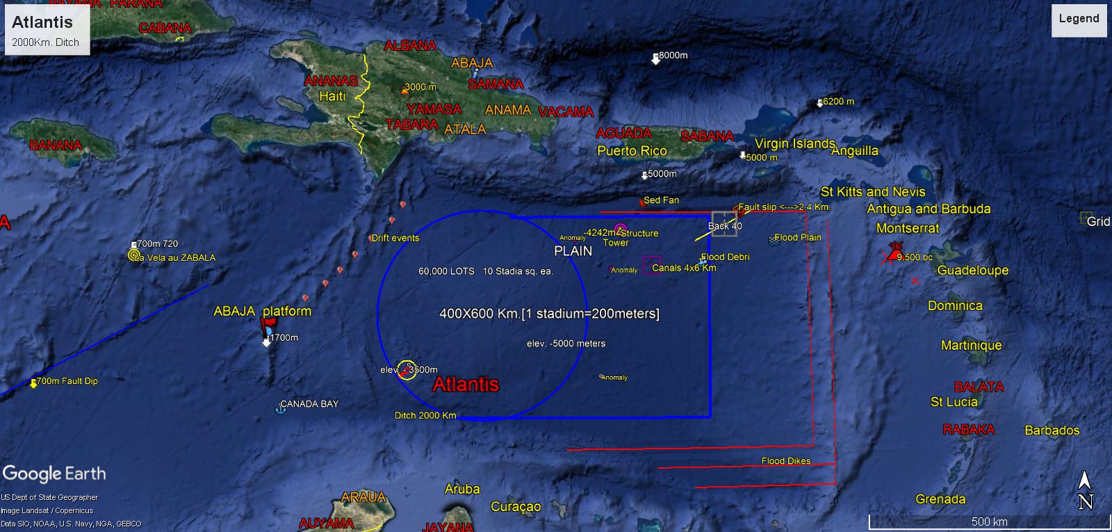
8 Km. high Mountains to the North
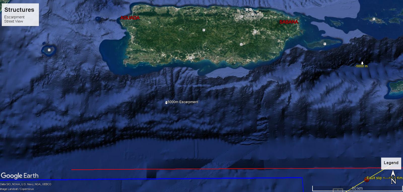
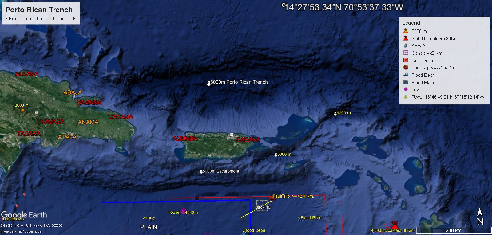
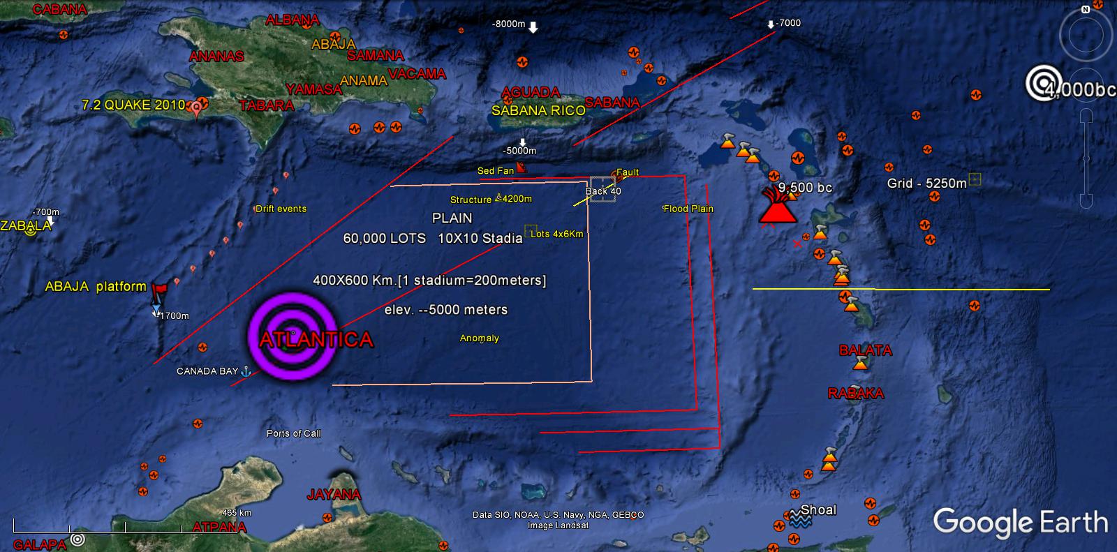

Flood Plain, Canals, Area of Flood Debri, Back 40 Sq.Km. Structures showing 2.4Km. Fault Slip.
800 meter Tower with 5Km. base.

Canals showing through the Fault line.

Pyramid
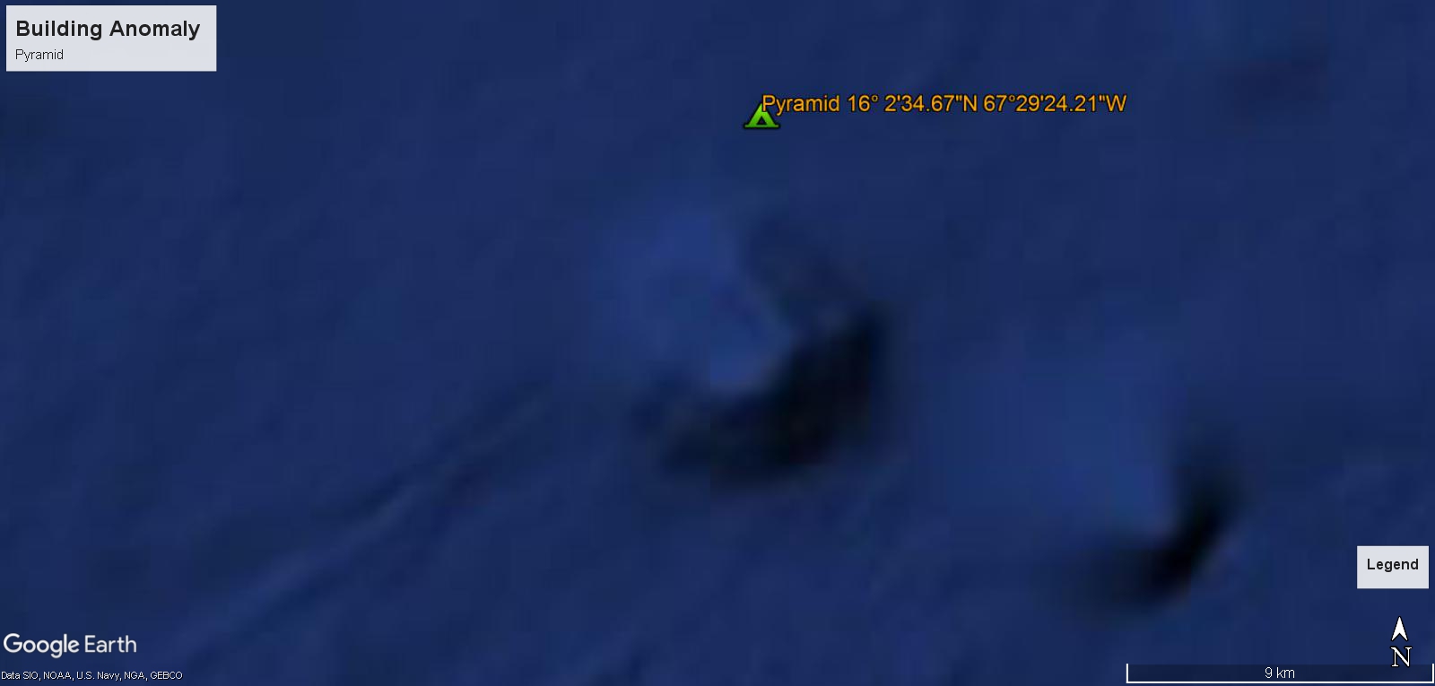
Building Anomalies
Dominica Volcano
30 KM. Caldera
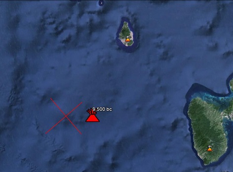
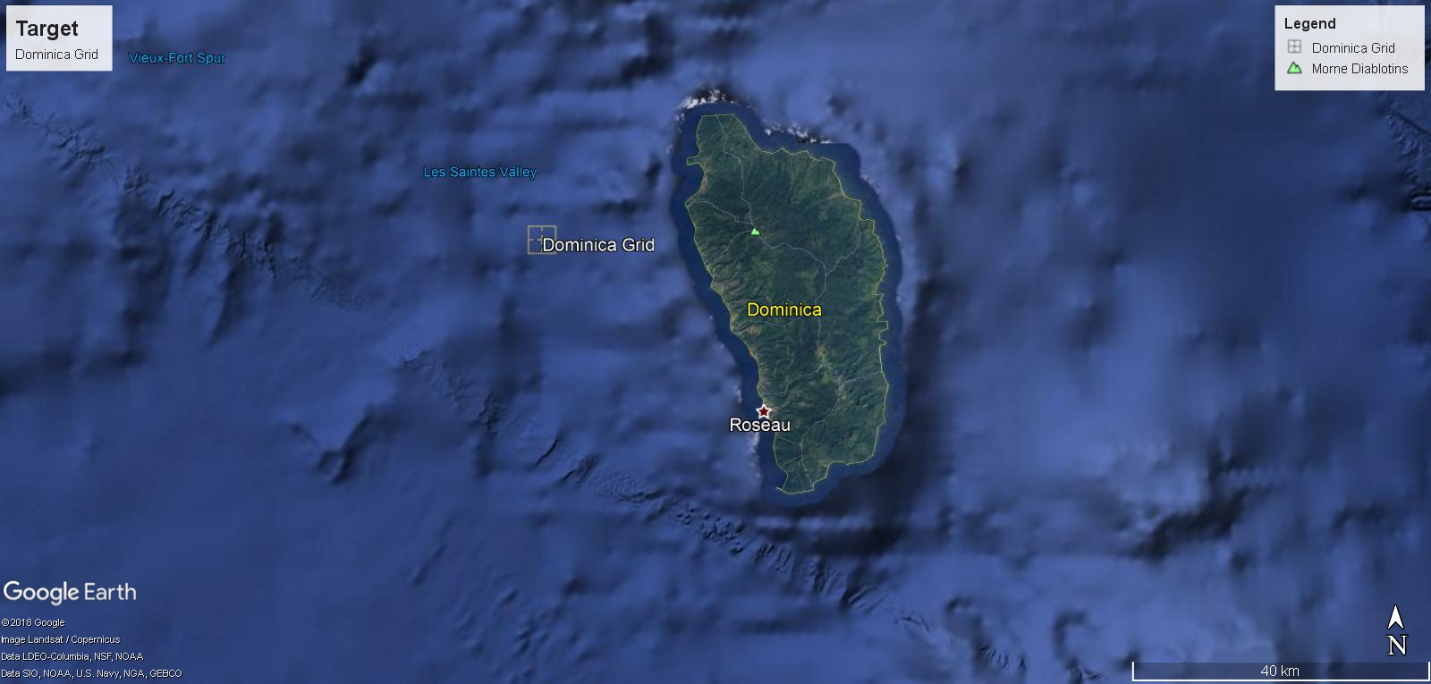
14 Water Spouts in modern times.
Dominica is on the Main Island of Atlantis
{2000 x 1000 Km. sinking 5 Km.}
Thus, the Island sunk as much volume as was expelled from the Fountains of the Great Deep. The initial high pressure spout would reach the upper atmosphere preserving the showings listed as the Island sunk accordingly.
A flood of Biblical proportion witnessed from America to Asia repeatedly as recurring events from 9,600 bc. to 2,400 bc. , from Deucaleon to Noah.
11 Deucaleon
The Super Heated Water caused the Younger Dryas Deep Freeze to abruptly end 9,600bc.
10 Chaldean Flood
9 Noah’s Flood
https://seyahacademy.ca/stardust-project-ii/
Atlantis
The citadel, 400x600km. plain, 2000 km. ditch, canal grid, flood plain, back 40, 8km. north cliffs, flood debris, volcanos 9500Bc, 800 m tower, fault drifts, dikes, mountain skeleton and Zabala…
Make a Copy
{Limited time Offer}
Links:
http://seyahacademy.ca/atlas-atlantis/
http://seyahacademy.ca/atlas-of-atlantis-ii/
http://seyahacademy.ca/stardust-project-ii/
PLATO-by-C M Gold
Antediluvian-World-by- I L Donnelly
https://www.holybooks.com/wp-content/uploads/Beelzebubs-Tales-to-His-Grandson-by-G-I-Gurdjieff.pdf
Atlantis Discovery Plan
–End–
Seyah’s Explorations
SHARE
Hits: 10418
As I site possessor I believe the content matter here is rattling great , appreciate it for your efforts. You should keep it up forever! Best of luck.
Hiya! I simply wish to give a huge thumbs up for the great info you may have right here on this post. I will probably be coming again to your weblog for extra soon.
I’m typically to blogging and i actually admire your content. The article has actually peaks my interest. I am going to bookmark your site and hold checking for brand spanking new information.
Your style is unique compared to other folks I have readstuff from. Many thanks for posting when you’ve got the opportunity, Guess I will just book markthis blog.
It’s really a cool and helpful piece of information. I am glad that you shared this helpful info with us. Please stay us informed like this. Thank you for sharing.
Thank you for the sensible critique. Me and my neighbor were just preparing to do some research about this. We got a grab a book from our local library but I think I learned more clear from this post. I am very glad to see such great information being shared freely out there. Caresa Matthus Volnay
Hiya very cool site!! Man .. Excellent .. Wonderful .. I’ll bookmark your website and take the feeds additionally厈I am happy to search out numerous useful info right here within the submit, we need develop more strategies on this regard, thank you for sharing. . . . . .
Wow! This can be one particular of the most beneficial blogs We have ever arrive across on this subject. Basically Fantastic. I am also a specialist in this topic so I can understand your effort.
I am not sure where you are getting your info, but great topic. I needs to spend some time learning much more or understanding more. Thanks for fantastic info I was looking for this information for my mission.